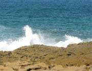
Gulf of Oman Coasts (Part 1)

The breathtaking shore of the Gulf of Oman is the most important tourist attraction in Jask, Hormozgan Province. The azure water of the Gulf of Oman is the result of the advancement of the Indian Ocean into the mainland in southwest Asia, located in northwest Arabian Sea, Indian Ocean, east of the Strait of Hormuz and Persian Gulf, and adjacent to Iran, Oman and Pakistan. The Gulf is indeed bounded on three sides to the land and on one side to the free waters (Indian Ocean). This small oceanic basin is the remaining part of an ancient vast ocean called Neo Tethys, that has been minimized as a result of the crash of Arabian plate with Eurasia. This historical sea is 903,000 km in size, with maximum length from northwest to southeast at 950 km and maximum width from northeast to southwest at around 340 km. Although the Gulf of Oman has lesser width in comparison with the Persian Gulf, it is deeper instead. The more we move westward, the depth is diminished sharply. The depth of the Gulf of Oman around Chabahar Port in Sistan-Baluchestan is around 3398 meters and in the vicinity of the Strait of Hormuz it is about 73 meters. The water in the Gulf of Oman is saline to some degree, i.e. 37 PSU in 1000 KG. The length of Iranian shore along the Gulf of Oman, from Gwadar Port to Bandar Abbas, is 784 km. The distance constitutes half of Iran’s southern seashores.
The gulf is located in the tropical hemisphere of the earth. The maximum temperature of water in August is 33 degrees and in January it is around 19.8 degrees centigrade. On the shoreline of this historical Gulf there are important cities namely Bandar Chabahar and Jask (in Iran) and Muscat and Sohar (in Oman). Chabahar Port in Sistan-Baluchestan of Iran is indeed the closest and easiest way of access to free waters for the Central Asian republics.
Translated by: Sadroddin Musawi
Other links:
Geographical Position, Hormozgan
Townships, Hormozgan
Historical Monuments, Hormozgan